For photographers, Landmannalaugar is probably the most interesting place you can visit in Iceland. A geothermal area at the northwest part of the fascinating caldera Torfajökull is characterized by a unique lava field, colorful rhyolite mountains, volcanos, blowing steam, and exciting hiking trails. It is my favorite place in Iceland and an extraordinary place for photographers and landscape photography.
My favorite spot on the hiking trail leading up to Brennisteinsalda volcano
In Landmannalaugar, there are several spectacular hiking tracks, and all of them are great for photography. One of the most popular ones in Laugahringur leading through the lava field, up to the top of the colorful volcano Brennisteinsalda and back through the lava again through the fantastic Grænagil. Armed with a camera and a 14mm to 24mm lens, you are almost secure to take home some spectacular photos. The variety in the landform gives you multiple options to shoot exciting landscape photos with multiple foreground options and background options.
Landmannalaugar service center seen from the south - hiking trail Vörðuhnúkur
My first visit to Landmannalaugar was half a century ago. I was 14 years old at the time. It was an adventure magnified by the 4X4 off-road drive and river crossing, the colorful rhyolite mountains, the geothermal pool, glacial streams, crystal clear creeks, and beautiful lakes, and the overall stillness of the highland. Although I came from a small town with access to nature, this visit was a new experience, my feelings elevating to a new level. Classifying it as divine may be stretching it a bit far, but this three-day tour gave me access to a territory of inner feelings that have stayed with me ever since. Retrospectively, I realized that it was a life-changing event and how powerful the effect of being out in nature can be.
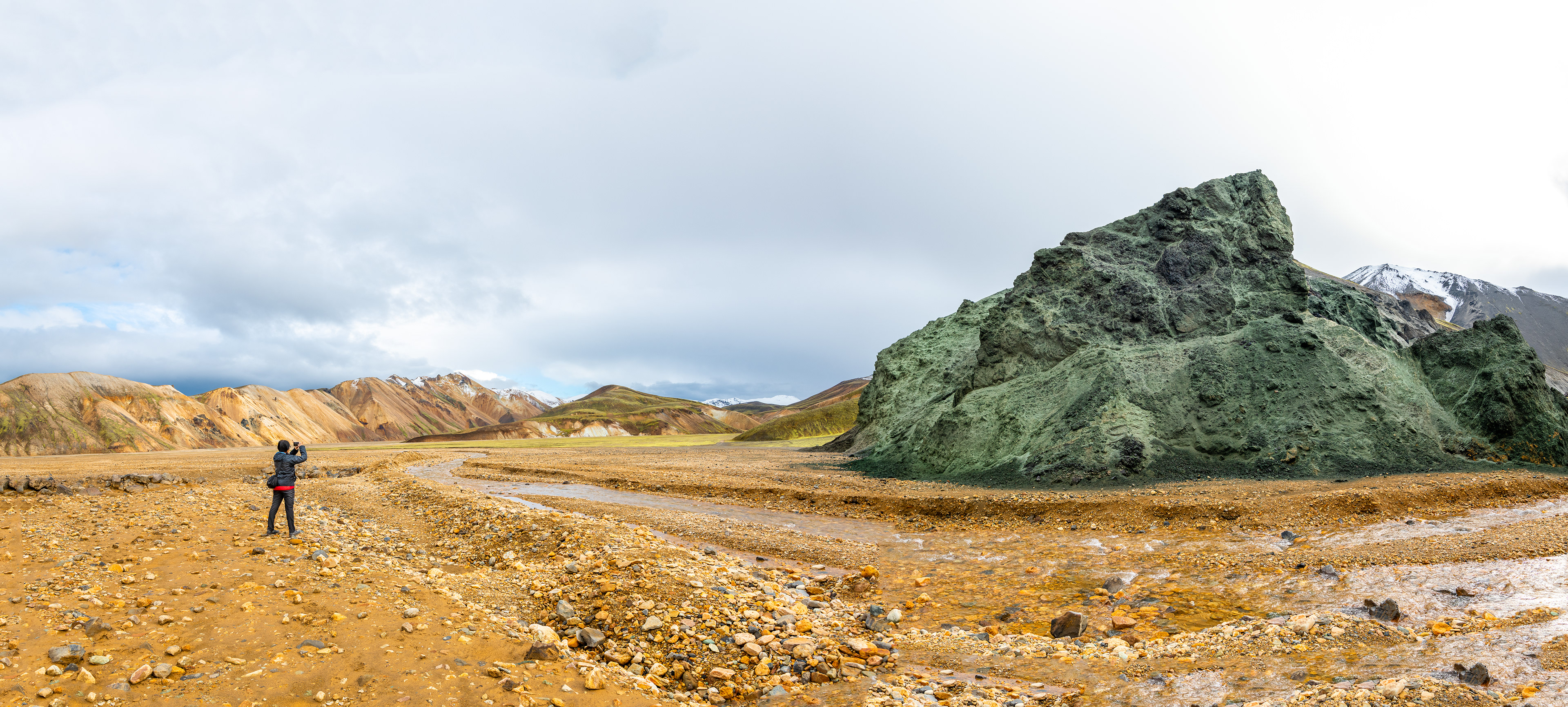
Standing at the mouth of Grænagil gulley looking towards Jökulgil
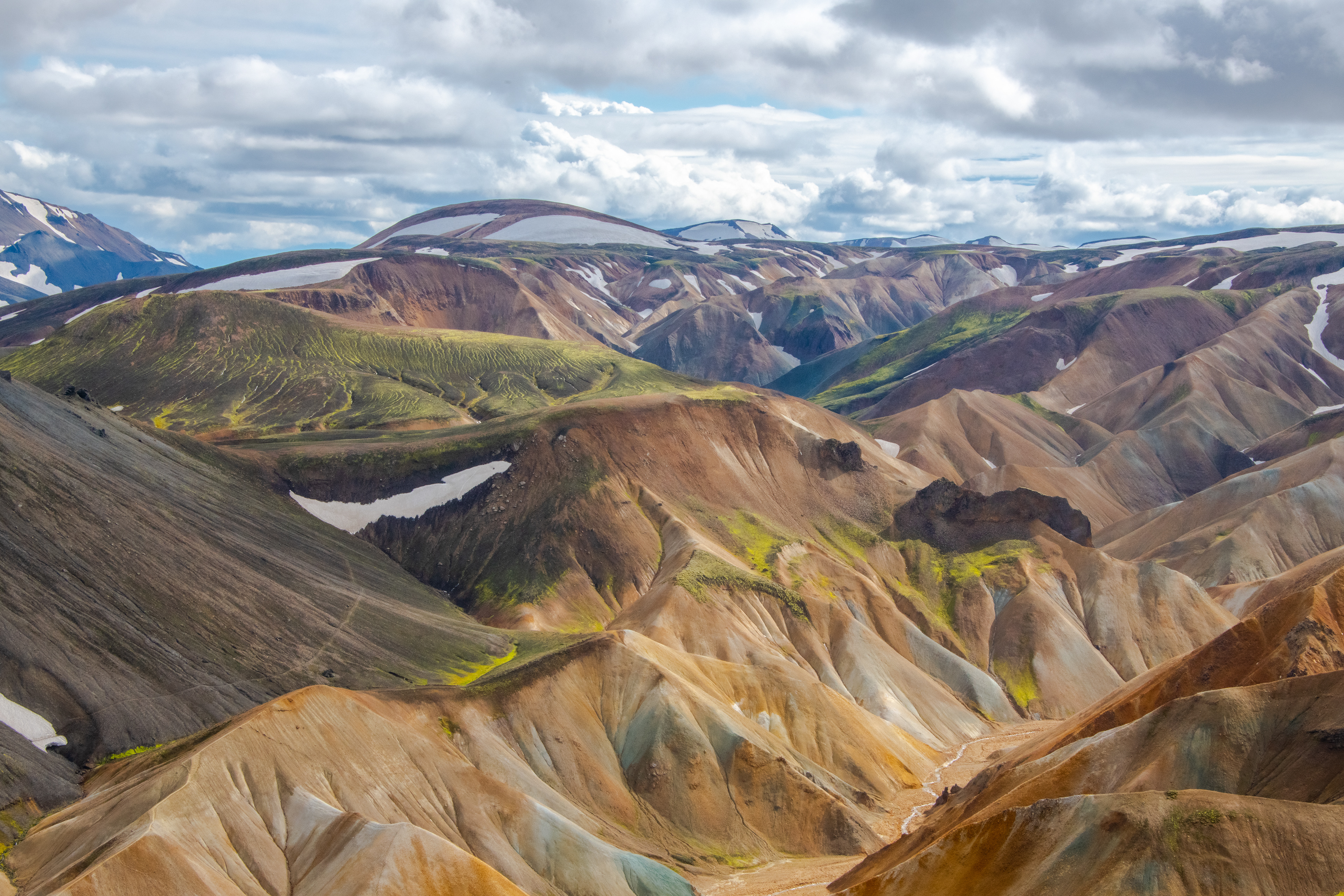
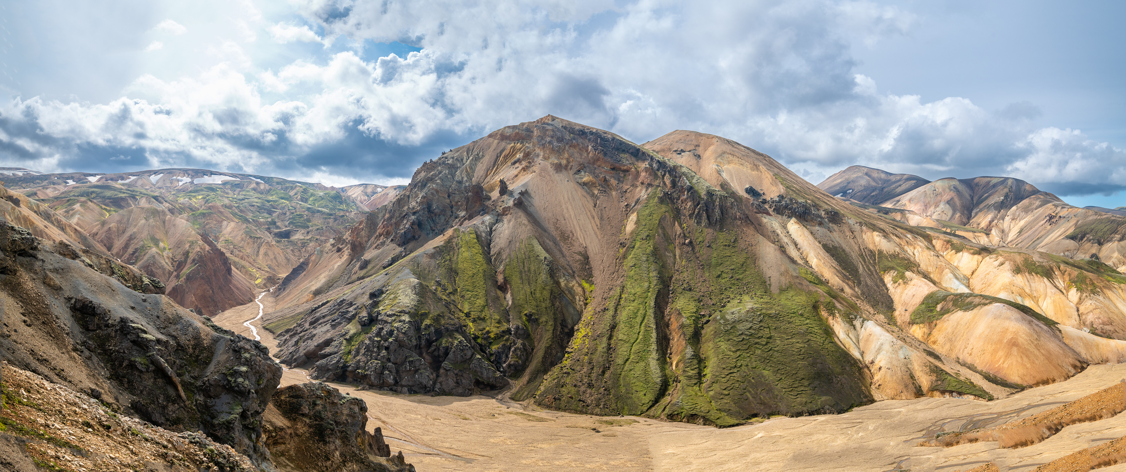
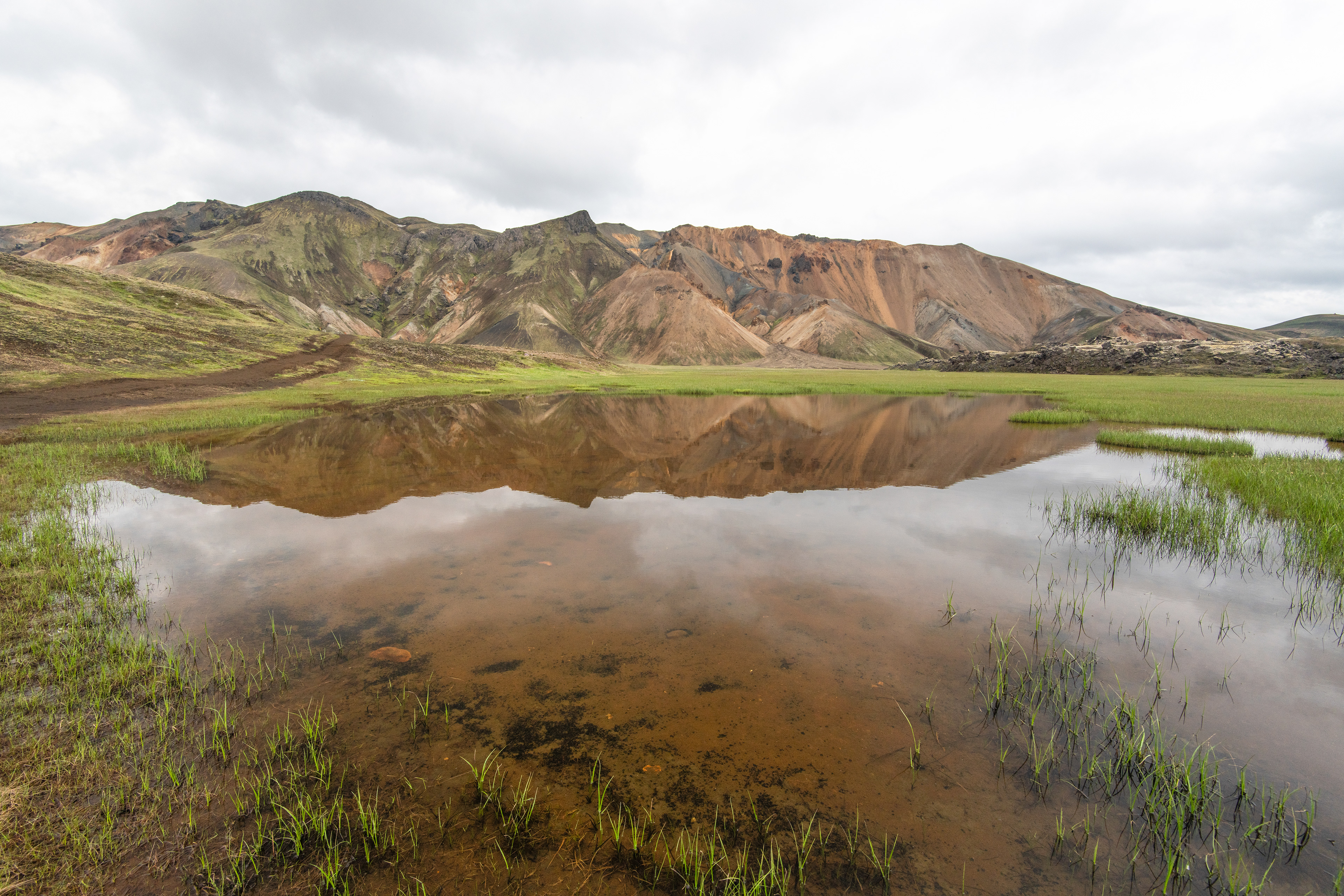
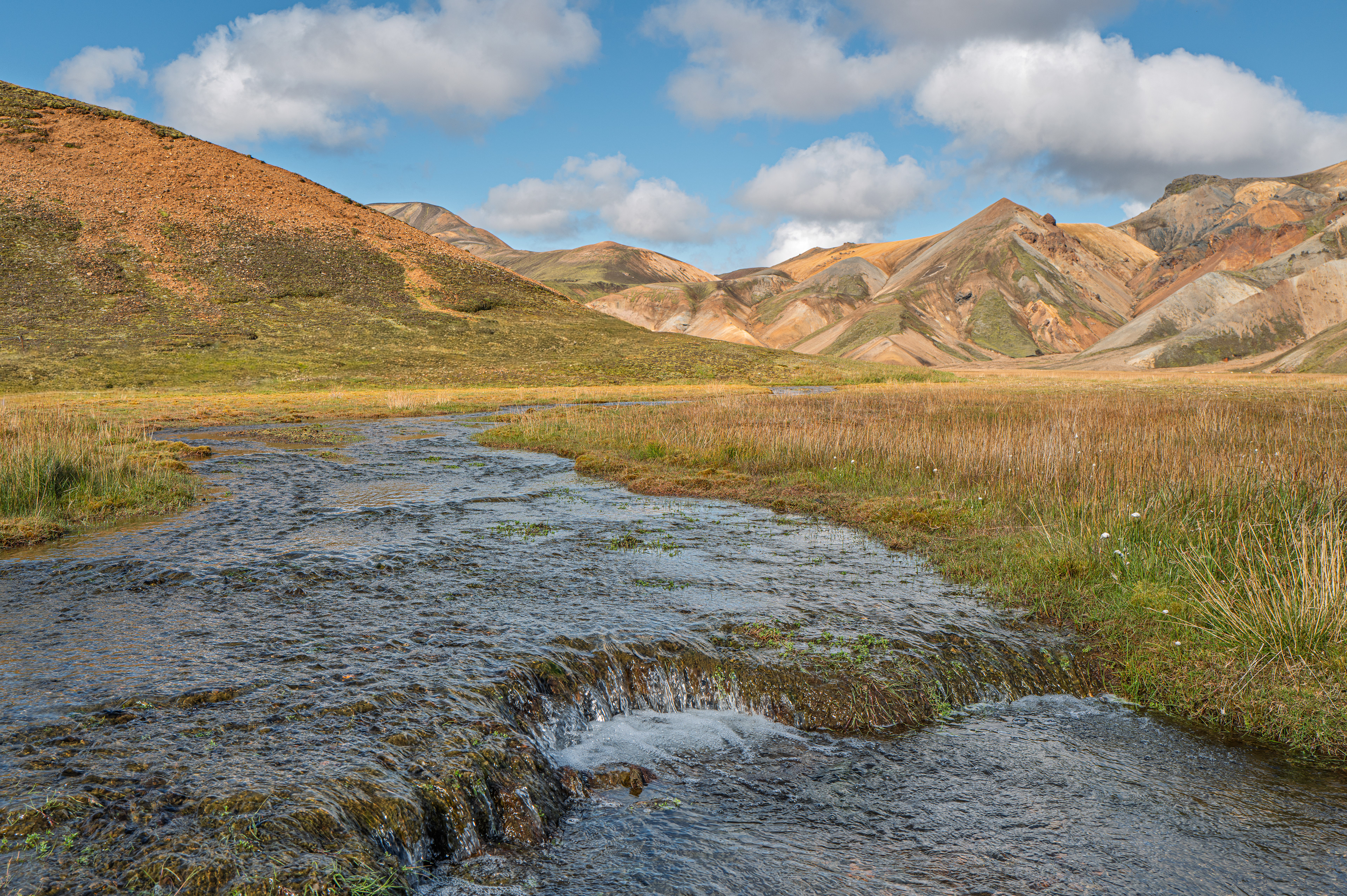
Landmannalaugar is located in the north-west part of the Torfajökull caldera, one of the most fascinating geological wonders on Earth. Due to the magma’s chemical composition below the caldera, it produced a large mass of colorful rhyolite mountains over thousands of years. In most cases, a spectacular natural marvel is comprised of two or three natural phenomena, like a waterfall falling down a cliff of basalt column stacks or a glacier tongue forming a lagoon with floating icebergs. Landmannalaugar, on the other hand, is a region entirely packed with numerous stunning ingredients of natural wonders, each of which can singlehandedly move you to emotional heights. This corner of Torfajökull caldera is surrounded by colorful mountains and sits on high-temperature geothermal heat constantly blowing steam from the endless source of groundwater delivering bright sulfur, iron, and other chemicals from the deep ground. It accumulated small colorful sculptures in a matter of centuries, or geological seconds, adding to the rhyolite color variety. The vegetation is specific to the Icelandic highland, with neon green fountain apple moss glowing in the harsh environment of gorges and ravines that separate colorful hills and mountains. There is also a unique lava field that is a rare combination of basalt and obsidian, an illegitimate child of two different volcanos with dissimilar magma composition.
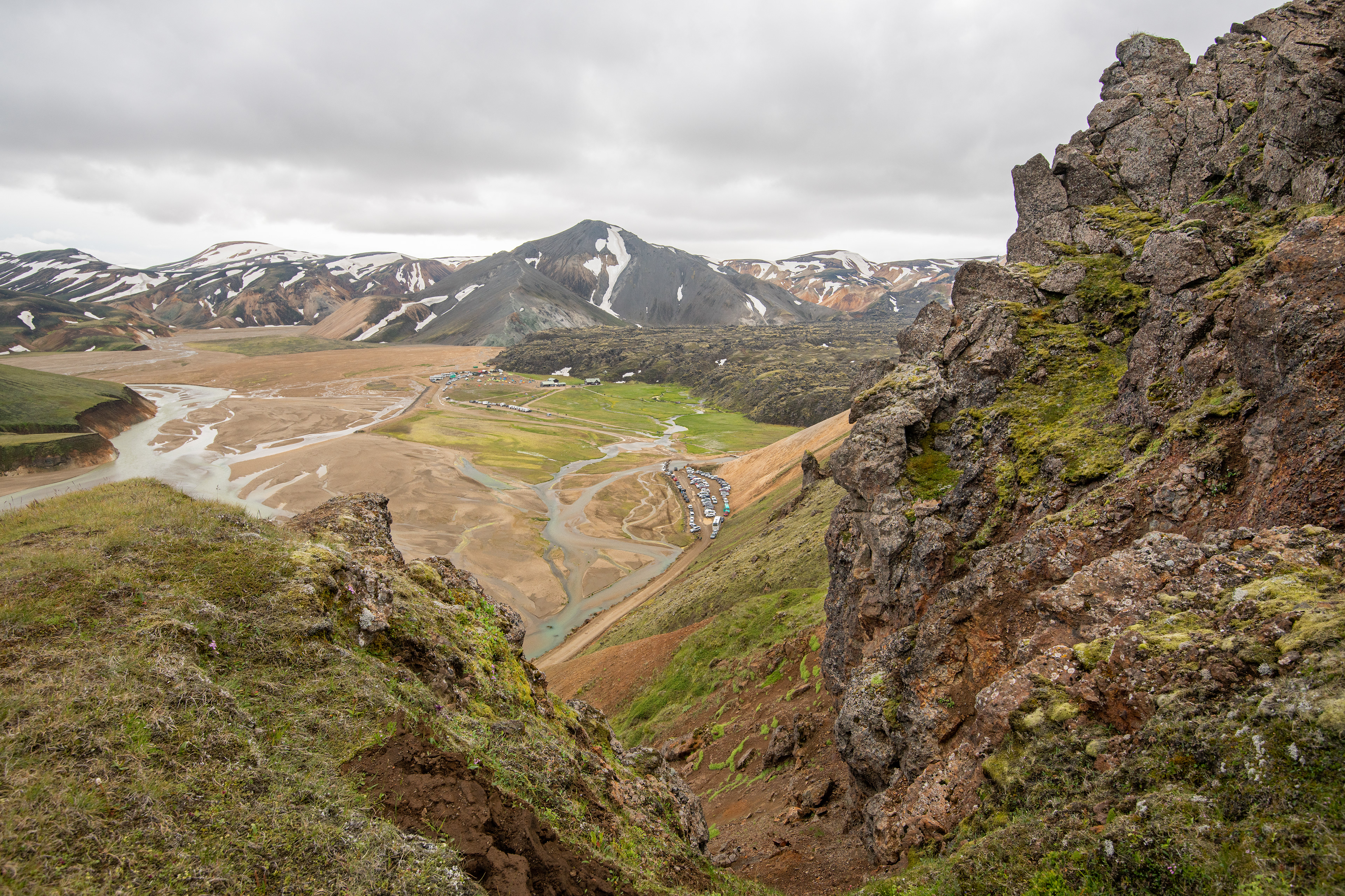
Landmannalaugar service center seen from the hiking trail Suðurnámur
In recent decades, I have visited Landmannalaugar hundreds of times. Since the weather always plays a significant role in Iceland, I often think about Landmannalaugar as the playground for the mighty weather gods Njörður and his son Freyr from Norse Mythology. It is a place where they can instantly display their power without compromising the landscapes’ appeal, however bad their mood is. The wind can be so strong that all your belongings, including your tent, can be blown away into the mountains. But that only occurs about once or twice every summer.
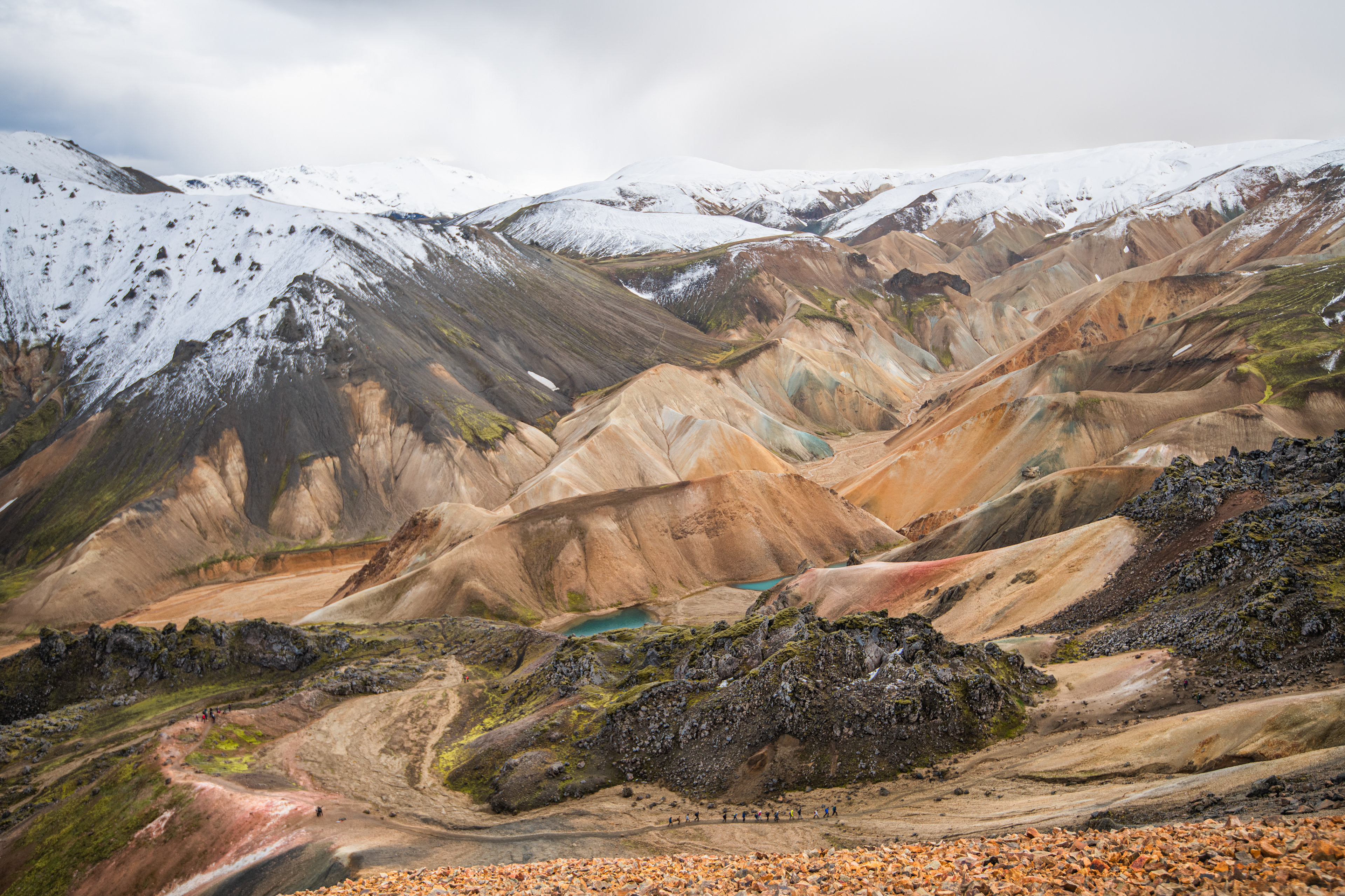
A view to the colourful mountains of Torfajökull caldera
There are innumerable mountains from different periods that act as a ground for multiple hiking tracks with exceptional views. The beautiful valleys are decorated with small waterfalls and picturesque ponds and hopefully dormant but possibly active colorful craters. Last but not the least, there is a natural geothermal bath if you need further relaxation after a mind-blowing hike that can make you high in more than one sense of the word.
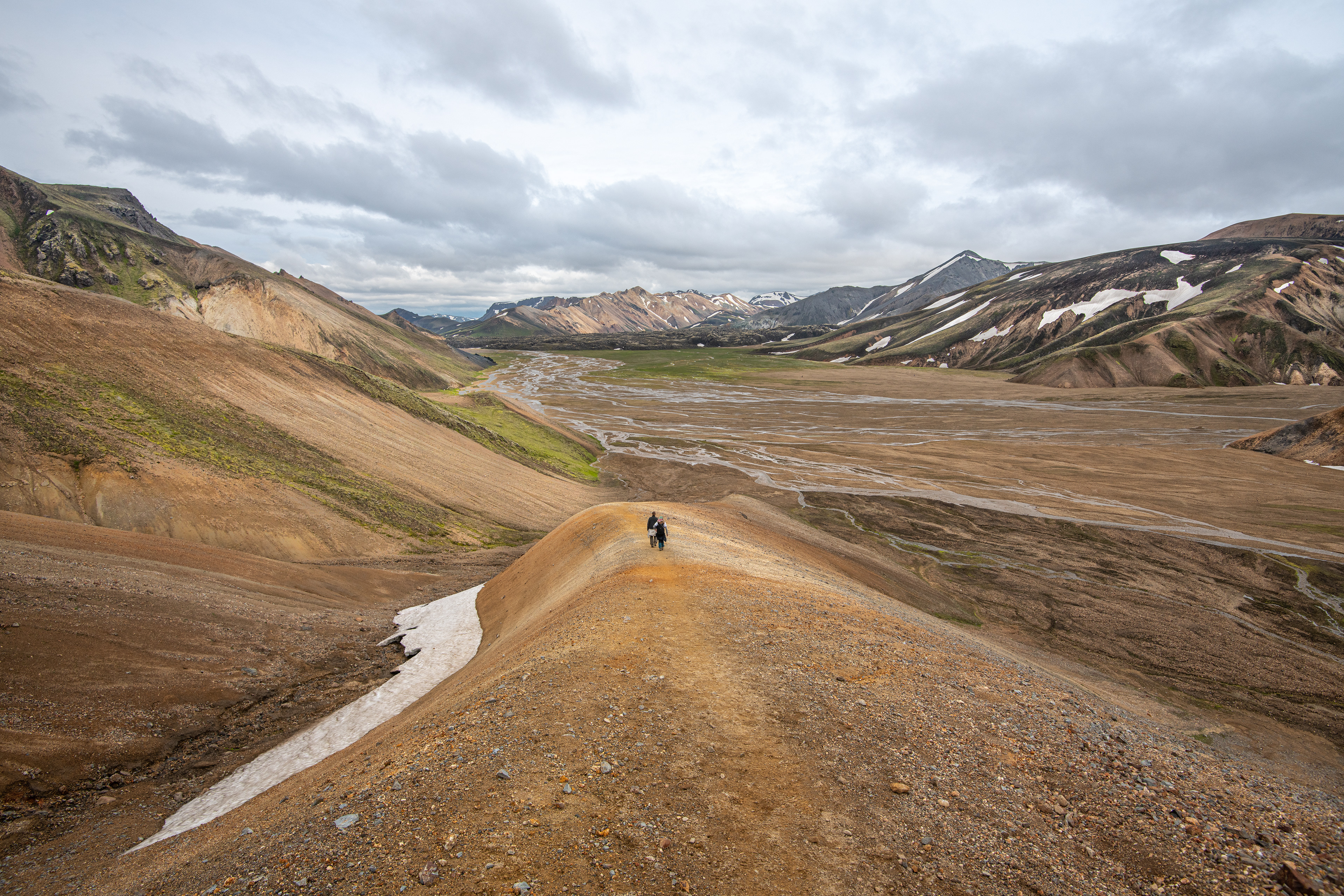
View from the north east towards Landmannalaugar
Many tourists that visit Landmannalaugar only stop for a day. Although a one-day tour is a fabulous way to get acquainted with this spectacular natural wonder, you should consider staying there for a few days if you are tempted to visit. There are numerous hiking trails to walk through each day. You can stay in a tent or a camper, depending on how much convenience you require. The Brennisteinsalda volcano and the Laugahringur lava are the most popular. They are led to by a well-marked track with an elevation of 300 meters. This is also the most popular hiking track for those who take a one-day tour. On the top is a monumental 360-degree view that extends to the magnificent landscape of mountains, large glacial rivers, volcanos, and glaciers. Walking through the Laugahraun lava that surfaced in an eruption in 1477 and Grænagil gulley at the end gives the hike a mysterious atmosphere.
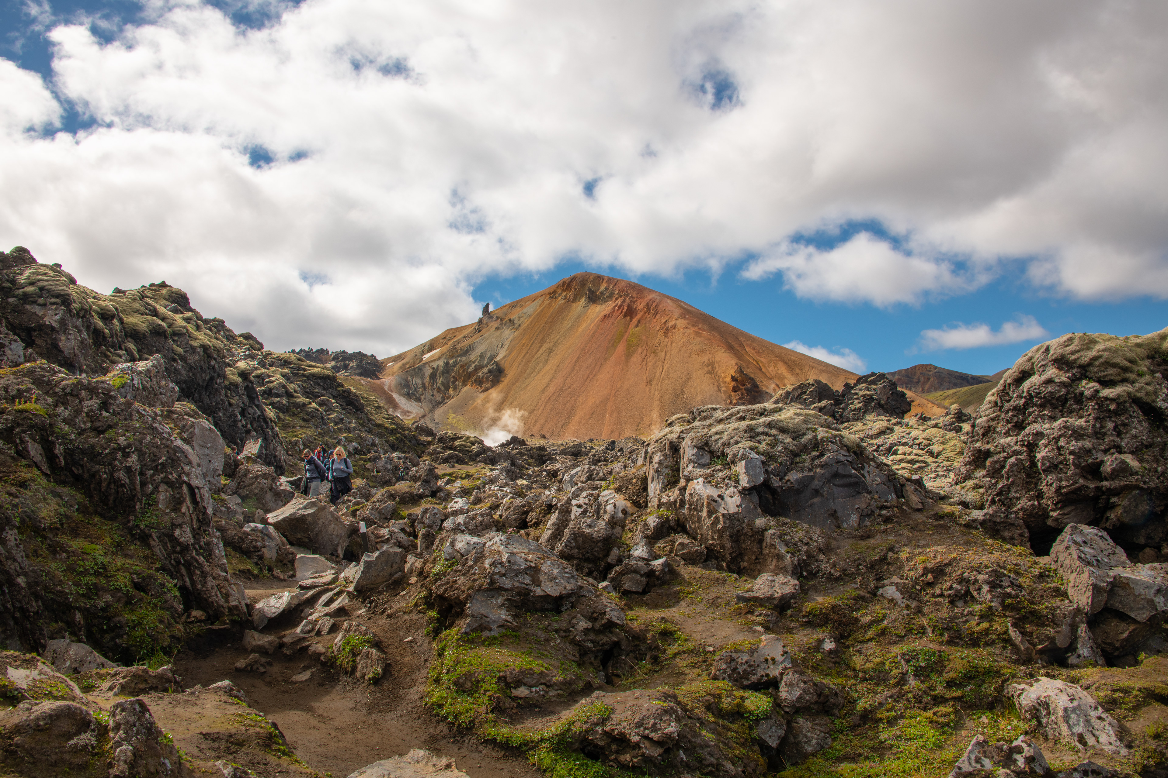
Volcano Brennisteinsalda is an icon mountain in Landmannalaugar
Other hiking tracks lead to the older sibling of Brennisteinsalda, Bláhnúkur, the captivating mountain ridge Suðurnámur, the highest point Háalda (through a one-day hike), and Skalli (needing a hectic one-day tour). A lighter one-day hike can be on the reasonably even track to visit Ljóipollur (meaning “ugly puddle”) crater through the mesmerizing volcanic landscape. For the more adventurous, experienced, and qualified hikers who crave challenging walks, a two- or three-day hiking tour into the distinctive landform of the Torfajökull caldera is also an option. Few have visited the Hattver and Grænihryggur ridge places that require good planning and professional gear.
Skalli (Baldhead) in the middle of Torfajökull Caldera an iconic mountain
In Landmannalaugar, you are at the mercy of enormous natural forces, emerging from deep within the earth’s crust and up toward the skies, witnessing the interplay between them.
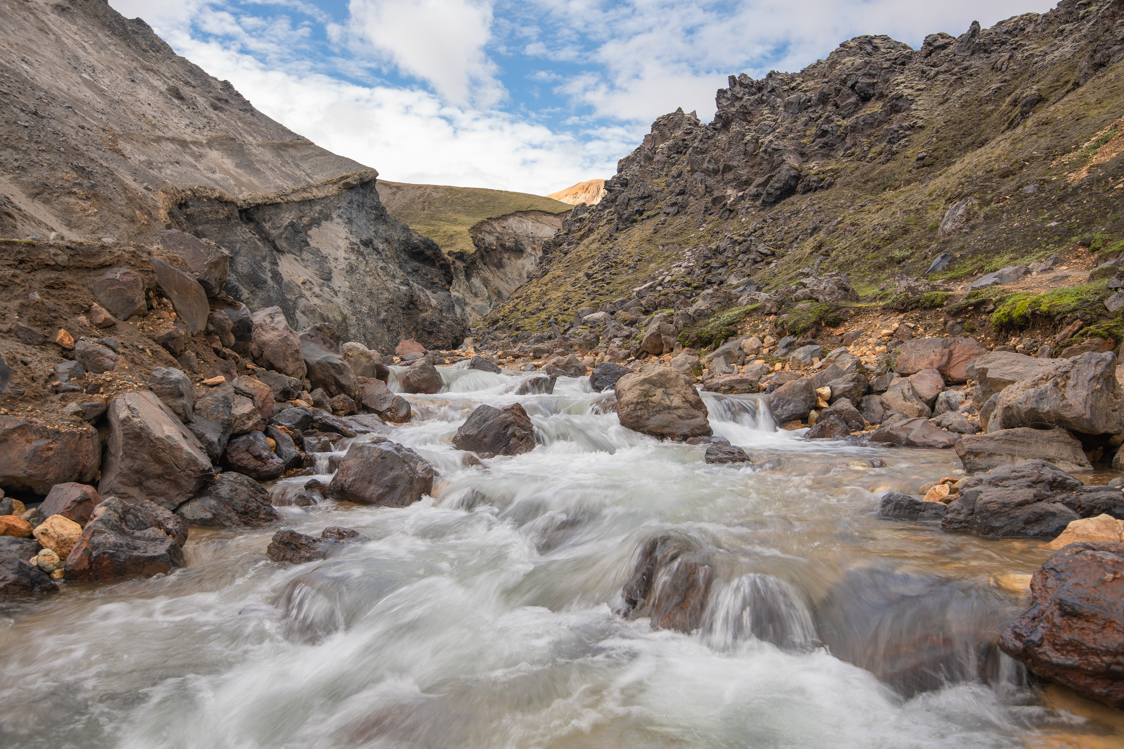
Grænagil and the river Brennisteinsöldukvísl
Sometimes during the day, Njörður and Freyr play with rain, wind, and clouds in a way that the whole complexity of the landscape is displayed like an illusion, from dark to shining bright, from wet to dry when a small beam of the sun heats the hills, from a calm wind to a decisive blow in a timeframe of a short three-hour hike. I have often taken tourists to this location and hiked up to the Brennisteinsalda volcano with them and never been in the company of someone who has been disappointed. Every step of the hike, you are exposed to more landforms as you climb higher and higher up the small volcano, stretching hundreds of kilometers in all directions.
Vondugil ravine west of Landmannalaugar
Suðurnámur mountain offers many photographic opportunities
Vondugil valley in Landmannalaugar
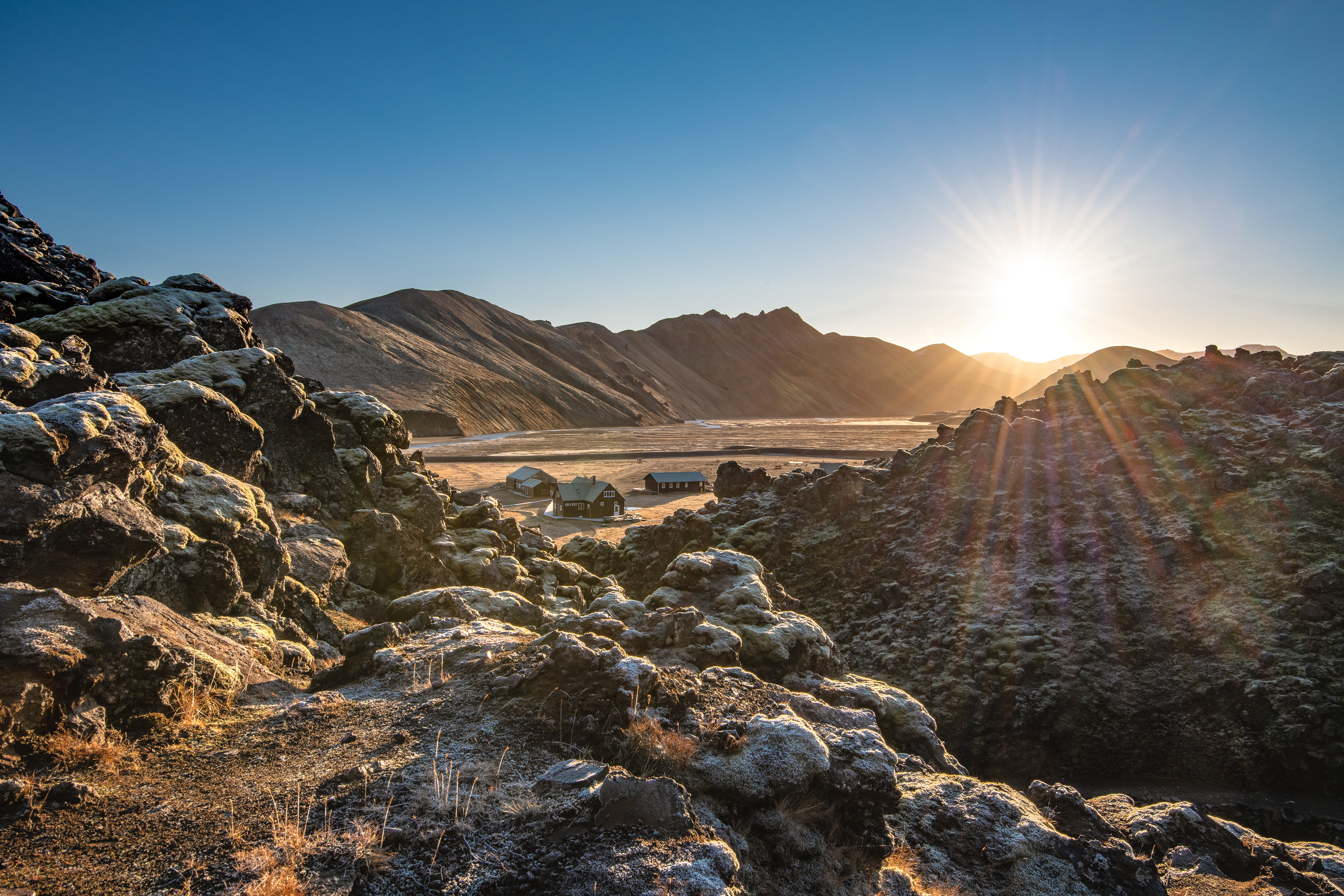
The service center at Landmannalaugar
In October, the weather gods take full control of both the Landmannalaugar and Torfajökull calderas and the Icelandic highland area. As the snow starts falling, the beautiful landscape is covered with a white blanket in a matter of days. The winter snow accumulates from one month to the next, until late April, when everything starts to melt, and the magnificent landform is displayed again from May to October.